At Lankhout Land Surveying & Geomatics M.L.S. Inc,, our qualified professionals have the experience and knowledge to see your project through.
We’re proud to provide trusted, efficient service in a range of areas including:
Property Survey, Subdivision, & More
- Cottage Surveys – We offer vivid, current aerial overlays (weather permitting) as part of our “Cottage Country” survey services. Using high-resolution drone imagery and advanced software, we stitch multiple images into a seamless mosaic. This mosaic is then superimposed over legally surveyed boundaries, giving clients a clear understanding of their property lines, building footprints, and overall site layout.
This visual approach makes it much easier to grasp the relationship between natural features and constructed elements. In short, a picture truly is worth a thousand words.
- Subdivision Application Map (SAM) – A Subdivision Application Map (SAM) is a sketch prepared by a Licensed Manitoba Land Surveyor. It shows the proposed lot lines and highlights key on-site and off-site features. This is often the first step in planning a land subdivision. (READ MORE ABOUT SAM)
- Plans of Survey for re-alignment – We provide professional plans of survey specifically for re-alignment projects in cottage country. These plans are essential for updating property boundaries, resolving discrepancies, and facilitating development or renovations.
- Drafting Services – We offer drafting support for all types of survey-related projects. Our experienced team delivers accurate and detailed plans that meet municipal and provincial standards.
- Subdivision – We help clients through the entire subdivision process. Whether you’re splitting a parcel into multiple lots, rearranging existing property boundaries, or registering legal instruments that subdivide land, we guide you every step of the way.
- Staking Certificates According to the Association of Manitoba Land Surveyors:
“A staking certificate, prepared by a Manitoba Land Surveyor, documents the placing of survey monuments on the limits of a particular parcel of land. It indicates the dimensions of the property and reports any building encroachments from or onto adjacent lands.”These certificates are crucial for confirming legal boundary placement and resolving encroachment concerns.
- Building Location Certificates (BLC) – As defined by the Association of Manitoba Land Surveyors:
“A Building Location Certificate (BLC) is a legal document prepared by a Manitoba Land Surveyor which shows the exact dimensions and positions of the land and buildings on a particular property. It reports any encroachments onto or from adjoining properties. No survey monuments are placed unless specifically requested.”BLCs are often required for real estate transactions and municipal approvals.
- Topographic Surveys – Topographic surveys provide a detailed representation of a property’s terrain. They measure horizontal distances, elevation differences, and directional relationships. These surveys are essential for engineering, landscaping, and construction planning.
- Lot Grading Plans (Infills) – We specialize in preparing pre-approved lot grading plans for infill developments. These plans are tailored to meet the Winnipeg Water and Waste permit process requirements. Moreover, we coordinate with professional engineers to develop rural and urban grading plans as needed.
- Drainage Control – We assist clients in solving drainage issues while minimizing costs. Our team facilitates collaboration with engineers to analyze data and address design constraints effectively.
- Pile, Building, Construction Layout – From small residential structures to large-scale capital projects, we provide construction layout services throughout Manitoba and Western Ontario. Our accurate layouts ensure smooth project execution and compliance with design specifications.
- Site Planning – Site planning is a crucial step in landscape architecture and development. It involves organizing land use, zoning, access, circulation, privacy, shelter, drainage, and more. Our services help clients turn ideas into functional, well-designed spaces.
- GPS Control – We use Global Positioning Systems (GPS) to establish precise control points for survey projects. Lankhout’s staff has extensive experience in GPS technology—from planning and field data collection to geodesy and final reporting—ensuring dependable and practical results.
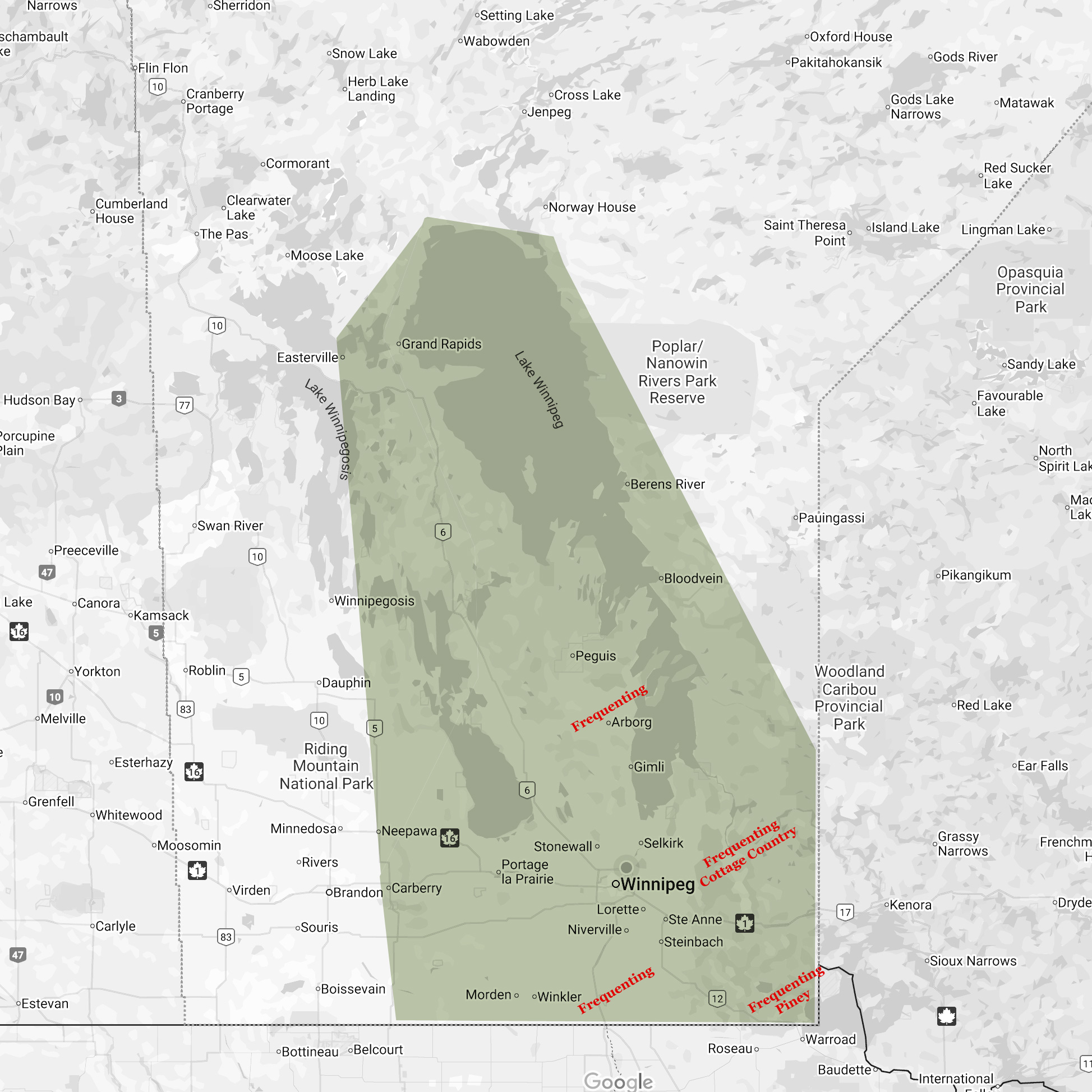
Areas We Serve
COTTAGE COUNTRY!!!
Frequenting weekly in summer months, from Falcon Lake ……. Nopiming Park, from
West Hawk Lake to Lac Du Bonnet – Wpg River
… Gull Lake to Victoria Beach, including Manigotagan;
Frequenting, but not limited to RM of:
- Springfield
- Piney
- Reynolds
- Hanover
- Bifrost Riverton
- Fisher
- Rhineland
- Stanley
- Montcalm
- Roland
- La Broquerie
- Whitemouth
- Lac Du Bonnet
- Brokenhead
- Alexander
- Tache
- St. Laurent
- Woodlands
- Rockwood
- Ritchot
- West & East St. Paul
- St. Clements
- St. Andrews
- Gimli
- North Northfolk
- Norfolk Treherne _ Pembina Valley
- Grahamdale
- Winnipeg

We’re a Proud Member of the Association of Manitoba Land Surveyors (AMLS)
According to the AMLS, a licensed Manitoba Land Surveyor “is the person charged with the responsibility of advising on or determining the location of all corners or boundaries of a property within the province of Manitoba. A Manitoba Land Surveyor’s authority is granted under The Land Surveyors Act, C.C.S.M. c. L60. Land surveyors are professionals with a specialized knowledge of the legal aspects of real property, land use and planning. They have been trained in the mathematical and related sciences appurtenant to their field and are required to meet high standards of qualifications before being authorized to practise. Land surveyors perform work with patience, sound judgement and logical thinking… Only a licensed Manitoba Land Surveyor has the legal authority and expertise to properly define the legal boundaries of a parcel of land either on the ground or on paper.

